Just a year ago we were dealing with an historically devastating Atlantic hurricane season. It was marked by the strongest hurricane – Irma – ever observed in the open Atlantic, the near total devastation of Puerto Rico by a similarly powerful category 5 monster Maria, and Hurricane Harvey – the worst flooding event in US history.
At the time, I commented here and elsewhere about the role climate change had played in amplifying the destructive characteristics of these storms.
Not to be outdone, the 2018 Atlantic hurricane season, initially predicted to be quiet – quelled by an incipient El Niño event and cool, early summer ocean waters – has suddenly erupted. If the current disturbance in the western Gulf of Mexico known as “95L” earns the status of tropical storm, the 2018 season will be the second time in recorded history that we’ve seen five tropical storms simultaneously present in the Atlantic basin (the last time was in 1971).
What happened to cause all of this? An early autumn ocean “heat wave” has brought sea surface temperatures in the western Atlantic to bathtub-level warmth. Just as summer heat waves on land are greatly increased in frequency and intensity by even modest overall warming, so too are these ocean heat waves becoming more frequent and more extreme as the oceans continue warm. All else being equal, warmer oceans mean more energy to intensify tropical storms and hurricanes.
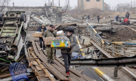
But when it comes to coastal threat, it hardly matters how many tropical storms there are over the course of the season. A single landfalling hurricane can wreak havoc and destruction. Think Katrina in 2005, Irene in 2011, Sandy in 2012, either Harvey or Maria in 2017 and now Florence in 2018.
In this sense, the sometimes fractious debate about whether we’ll see more or fewer storms in a warmer world is somewhat misplaced. What matters is that there is a consensus we’ll see stronger and worse flood-producing storms – and, in fact, we’re seeing them already. That brings us to Hurricane Florence: a climatologically-amplified triple threat.
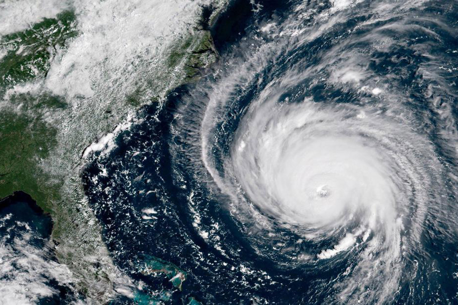
First, there is the threat of wind damage. Florence strengthened into a monster category 4 hurricane with 140 mile per hour winds over those very warm western Atlantic waters. Past studies indicate a roughly 7% increase in the peak wind speed of a category 4 storm for each 1C warming of ocean surface temperatures.
So the roughly 1.5C warmer-than-normal waters in the subtropical Atlantic where the storm intensified (and keep in mind that “normal” as modernly defined by NOAA as the average during the 1981-2010 period is itself already about 1C warmer than pre-industrial times prior to advent of human-caused greenhouse warming) corresponds to a roughly 11% increase in peak winds. But the destructive potential of a storm goes as the cube of the wind speed. That 11% increase in wind speed corresponds to a 33% increase in destructive potential. That’s not a subtle effect.
Fortunately those winds decreased substantially as the storm approached landfall. But even as a strong, very slowly moving hurricane pounding structures with near 100mph winds for hours on end, Florence is doing considerable damage as it skirts the long Carolina coastline, taking down trees and powerlines and rendering large areas without electricity.
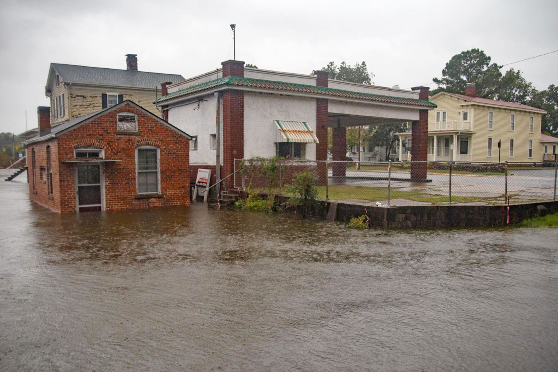
That brings us to the second, even greater threat: storm surge. Though the storm weakened as it approached the coast, the storm surge was built up over of a period of several days, including the time during which it existed as a category 4 or strong category 3 storm. That means the catastrophic, roughly-10ft storm surge from Cape Hatteras to Myrtle Beach was baked in well in advance of the landfall of the storm.
Don’t forget to add to that the 1ft of sea level rise that has occurred along the south-eastern US coast, mostly due to climate change (there’s a small contribution owing to the geological subsidence of the coast).
The wonderful little coastal North Carolina town of New Bern has been particularly hard hit, with the downtown area flooded by the 10ft storm surge and 200 people requiring rescue. It is seemingly prescient that I gave a lecture in New Bern last year, during last year’s storm season, warning about the coastal threat from climate change, in a church that has now been flooded by Florence.
Last, but not least, we have the threat of inland flooding. Warmer oceans mean more moisture in the atmosphere. It’s one of the simplest relationships in all of meteorology: for each 1C of warming, there is about 7% more moisture in the air. That means those 1.5C-above-normal ocean temperatures have given the storm about 10% more moisture. All other things being equal, that implies about 10% more rainfall.
But that’s not the whole story. What made Harvey a record flooding event last year and makes Florence such a flooding threat now, is the slow-moving nature of the storm. The slower the storm moves, the more rainfall that accumulates in any one location and the more flooding you get. Such was the case with other devastating storms such as Harvey or 2011’s Hurricane Irene that caused historic flooding in my own state of Pennsylvania.
Some headlines have reported that Florence is a warning of what is to come. But in reality, it is a warning of what has already arrived. Far worse is to come if we don’t get serious, in a hurry, about acting on climate change. We must transition away from fossil fuels toward renewable energy even more rapidly, and we must elect politicians who will support such efforts.
In the US, there’s an opportunity to do so in less than two months now in the upcoming midterm elections, where we must elect politicians who support enlightened policies on energy and climate, and vote out of office those who don’t.
Michael E. Mann
Michael Candelori, NurPhoto/Sipa and NASA
Originally published on The Guardian as Hurricane Florence is a climate change triple threat
Help deliver the independent journalism that the world needs, make a contribution of support to The Guardian.